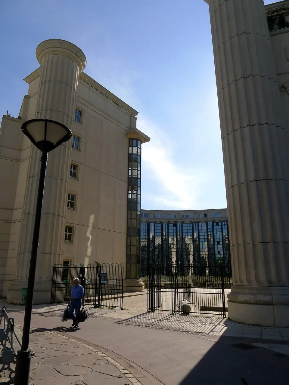
About Quartier de Plaisance
The Quartier de Plaisance is the 56th of Paris's 80 administrative neighborhoods and lies in the 14th arrondissement. It is bounded on the north and east by the Gare Montparnasse and the Boulevard Périphérique, while the Avenue du Maine, the Rue Daguerre, and the Avenue de la Porte de Châtillon mark its southern and western edges. The neighborhood takes its name from a historic farm dating to the 17th century that stood on what is now the Rue du Château. In the mid-19th century, the tenant farmer Alexandre Chauvelot popularized the name to attract buyers for the land there.
The area's history is one of transformation from rural to urban. Before the French Revolution, the land belonged to the Abbey of Saint-Geneviève and consisted of farmland, hunting grounds, and quarries. It was not officially annexed by Paris until 1860. In the early 19th century, taverns and entertainment venues sprang up outside the city walls of the time; exempt from the city's wine tax, they drew famous figures such as Victor Hugo and Eugène Delacroix. Urbanization proper began in 1830, led by real estate agents who divided the land into lots. Many streets still bear the names of the original owners or speculative developers. Even after becoming part of the city, the neighborhood was spared Haussmann's sweeping redevelopment and grew into a densely built residential district of small businesses, home mainly to workers and craftsmen.
Up to the end of the 20th century, the quartier was an important center of the labor movement and of the Resistance during World War II. Figures such as Jean Moulin and Missak Manouchian had roots here. A planned major project, the Vercingétorix radial road, was abandoned in the 1970s, but it led to the expropriation of a strip of land along the railway line. This made it possible to redevelop the neighborhood, which contributed to the creation of a green belt, new housing, and the Place de Catalogne. Today, the Quartier de Plaisance combines its historic character with the traces of its industrial and social past.
At a glance
- Category
- Sight › Historic sites
- Rating
- no reviews yet · write a review
- Address
- —
Paris, France - District
- 14th Arrondissement
- Phone
- —
- Website
- —
- —
- Coordinates
- 48.83050° N · 2.31417° E
- Data quality
- confidence 0.81
- Identifier
- ID 34be3cf1-87a…
Location & surroundings
Toggle layersRatings & comments
none yetNear Quartier de Plaisance
closest 5 per category · 2 kmRestaurants
Museums
Hotels
More:Historic sites in Paris (1,524)Sights in 14th Arrondissement (51)All sights in Paris (1,859)
234 places within 2 km loaded.
You need a free account to leave reviews and photos – that keeps comments genuine and lets you edit them later.