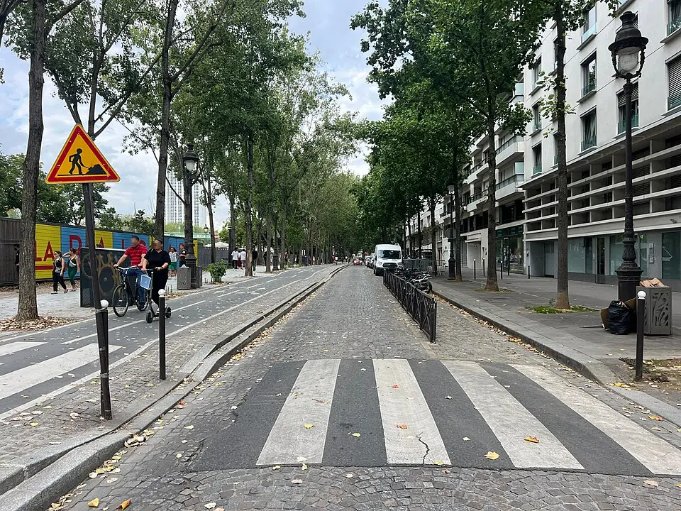
About Quai de la Loire
The Quai de la Loire runs along the Bassin de la Villette in Paris's 19th arrondissement, linking the Rue de Crimée with the intersection at the La Villette lock. Named after the longest river in France, the route was originally known as Route départementale N. 76. In 1829, following the construction of the Canal de l'Ourcq and the damming of the basin, it was developed into a waterfront promenade. It has carried its current name since 1857. Here you can stroll along the water, and the Jean Vigo and Éric Tabarly promenades, laid out in 2005 and 2008, offer especially pleasant spots to relax right at the water's edge.
At a glance
- Category
- Sight › Historic sites
- Rating
- no reviews yet · write a review
- Address
- —
Paris, France - District
- 19th Arrondissement
- Phone
- —
- Website
- —
- —
- Coordinates
- 48.88566° N · 2.37538° E
- Data quality
- confidence 0.83
- Identifier
- ID fd051ba1-dec…
Location & surroundings
Toggle layersRatings & comments
none yetNear Quai de la Loire
closest 5 per category · 2 kmSights
Museums
Hotels
More:Historic sites in Paris (1,524)Sights in 19th Arrondissement (17)All sights in Paris (1,859)
268 places within 2 km loaded.

You need a free account to leave reviews and photos – that keeps comments genuine and lets you edit them later.