About Untergiesing-Harlaching
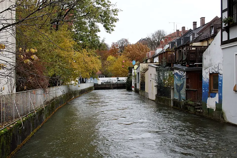
Untergiesing-Harlaching is the eighteenth borough of Munich, the Bavarian state capital, and combines two districts with very different historical and social characters. Untergiesing, in the northwest along the Isar River, only developed into a significant residential area in the nineteenth and twentieth centuries. The area was originally defined mainly by floodplain forest and a few mills on the Auer Mühlbach, with the oldest written mention of a mill dating to 957. The name Untergiesing refers to the settlement below the Nockherberg, which used to belong to the municipality of Au. Today the architecture bears witness to this past, for example in the small inns that still stand on Pilgersheimer Straße and the housing estate built by Münchner Siedlungsbau in 1930 in the New Objectivity style.
Harlaching lies in the southeast on the high terrace of the Isar's right bank and looks back on a long history that reaches as far as the Iron Age. The village was first mentioned in documents around 1150. The old village center was clustered around the St. Anna Kircherl on the Harlachinger Berg, which was first mentioned in 1186 as belonging to Tegernsee Abbey. After Harlaching was incorporated into Munich in 1854, a building boom began around 1900. Architects such as Gabriel von Seidl and Max Littmann designed the Gartenstadt Harlaching (Harlaching Garden City) on the grounds of the former palace, which has kept its green character to this day. This ensemble was complemented by the Menterschwaige villa colony on the high bank of the Isar. These areas shape the image of Alt-Harlaching, now regarded as an upscale villa neighborhood, while Neuharlaching is distinguished by looser development with single-family homes and apartment buildings from the 1920s.
For visitors and residents alike, the borough offers a varied mix of recreation, culture, and sports. A central attraction is Hellabrunn Zoo, which opened in the Isar floodplain in 1911 and, together with the restored Isar and Flaucher areas, plays an important role in leisure activities. In sports, the borough is known for the stadium on Grünwalder Straße, which has stood since 1911 and is closely tied to the history of TSV 1860 München. Club life is lively as well, for instance through TSV Turnerbund München, considered one of the oldest amateur sports clubs, and the Burschenverein Harlaching, which is dedicated to preserving Bavarian traditions. In addition, the municipal Harlaching Hospital, built on a former park site, provides basic medical care and has housed the rescue helicopter Christoph 1 since 1970.
At a glance
- Category
- Sight › Historic sites
- Rating
- no reviews yet · write a review
- Address
- —
Munich, Germany - District
- Untergiesing-Harlaching
- Phone
- —
- Website
- —
- —
- Coordinates
- 48.09222° N · 11.56056° E
- Data quality
- confidence 0.74
- Identifier
- ID a21811f0-3ca…
Location & surroundings
Toggle layersRatings & comments
none yetNear Untergiesing-Harlaching
closest 5 per category · 2 kmSights
Restaurants
Hotels
Cocktail bars
More:Historic sites in Munich (291)All sights in Munich (375)
81 places within 2 km loaded.
You need a free account to leave reviews and photos – that keeps comments genuine and lets you edit them later.