About Sendling-Westpark
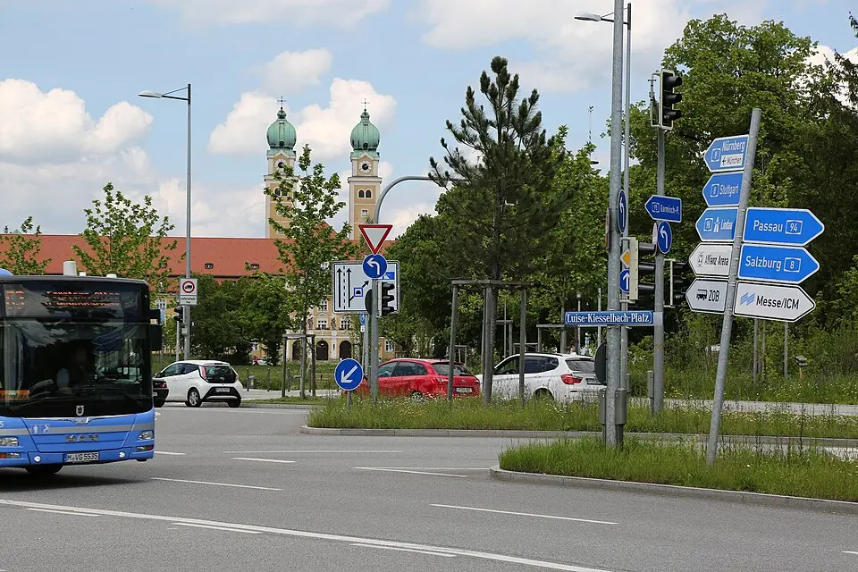
Sendling-Westpark is the seventh borough of Munich, the capital of Bavaria, and lies in the southwest of the city. The area stretches from Schwanthalerhöhe in the north to Obersendling in the south, with the eastern boundary formed by the railway line to Lenggries and the western boundary by Fürstenrieder Straße and Westendstraße. The borough was only created in 1992, in a district reform, from most of the former Waldfriedhofviertel district. It takes its name from the parts of historic Sendling it includes and from Westpark, a large green space originally laid out for the 1983 International Horticultural Exhibition. Historically, the area was part of the Sendlinger Haide, which before World War II was mostly used for farming or covered in forest. Actual development did not begin until after the war, when large residential estates were built for refugees and families.
Today, the borough is characterized by a mix of single- and two-family homes from the interwar period in the south and multistory apartment buildings along the main thoroughfares. Its infrastructure is dominated by the Middle Ring road and the U6 subway line, with the stations Partnachplatz, Westpark, and Holzapfelkreuth. Partnachplatz in particular is an architectural highlight, featuring a fountain by the sculptor Alfred Görig that symbolizes the Partnach Gorge. Despite the heavy traffic, the district has a high proportion of green space, including Westpark, parts of the Sendlinger Wald forest, and various neighborhood parks. In the northwest, on the grounds of the former Neufriedenheim sanatorium, a growing education campus is home to several secondary schools and other schools.
Visitors and residents alike will find a wide range of cultural and sports options in the borough. A central venue is the Rudi-Sedlmayer-Halle, which since 2023 has served as the home arena of FC Bayern Munich's basketball team under the name BMW Park. The Feierwerk youth cultural center on Hansastraße also draws many people with its citywide program. The history of the borough is closely tied to the postwar reconstruction after 1945, which is reflected in the architecture of its churches and residential complexes, some of which are listed as historic monuments. In recent years, the district has continued to evolve through infill development and the conversion of commercial space into housing, with city policy taking measures to preserve its social structure.
At a glance
- Category
- Sight › Historic sites
- Rating
- no reviews yet · write a review
- Address
- —
Munich, Germany - District
- Sendling-Westpark
- Phone
- —
- Website
- de.wikipedia.org
- —
- Coordinates
- 48.12220° N · 11.53190° E
- Data quality
- confidence 0.81
- Identifier
- ID fb732c91-a08…
Location & surroundings
Toggle layersRatings & comments
none yetNear Sendling-Westpark
closest 5 per category · 2 kmSights
Restaurants
Museums
Hotels
More:Historic sites in Munich (291)All sights in Munich (375)
158 places within 2 km loaded.
You need a free account to leave reviews and photos – that keeps comments genuine and lets you edit them later.