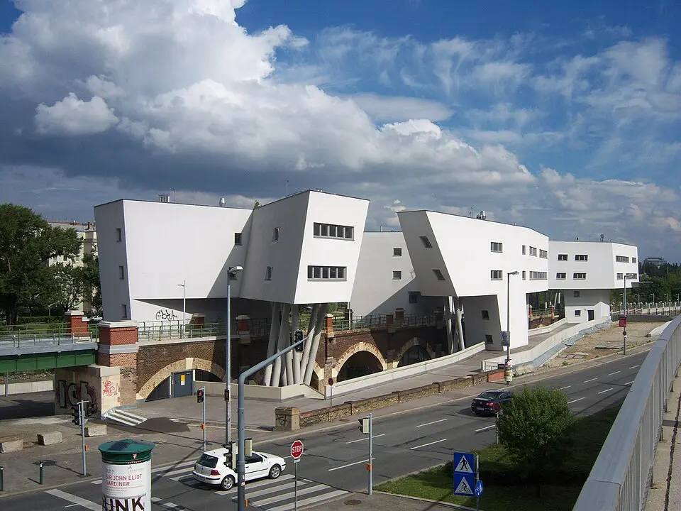
About Zaha Hadid-Haus
The Zaha Hadid House on Spittelauer Lände in Vienna's Alsergrund district is a striking three-part residential complex designed by the renowned architect Zaha Hadid. The building rests on the landmark-protected viaduct of the former Stadtbahn (city railway), which is now part of the U4 subway line. Because this stretch is no longer used for rail traffic at this point, the built-over arches at street level house cafés, restaurants, and shops. The project was part of the redevelopment of the Danube Canal waterfront, with the goal of making the area more appealing and creating a new scene near the Vienna University of Economics and Business. Originally, five structures in the form of winding ribbons were planned, but the final design comprises three buildings, which were constructed between 2004 and 2005.
The building's history has been shaped by changing uses and challenges. After the original developer went bankrupt and a period of vacancy, during which the building was at times nicknamed the "ghost house," it was later repurposed for students. Zaha Hadid herself distanced herself from the final result, since changes such as smaller windows and PVC flooring watered down her original design. Today the building is privately owned, and the current owner is trying to revive the complex as a co-living hotspot for students and tourists. This includes painting over illegal graffiti with large-scale graffiti art. Visitors can admire the building's architectural distinctiveness on the Danube Canal; despite its eventful past, it remains a fixture of the city's skyline.
At a glance
- Category
- Sight › Historic sites
- Rating
- no reviews yet · write a review
- Address
- Spittelauer Lände
1090 Vienna, Austria - District
- Katastralgemeinde Alsergrund
- Phone
- —
- Website
- de.wikipedia.org
- —
- Coordinates
- 48.23088° N · 16.36159° E
- Data quality
- confidence 0.85
- Identifier
- ID bb79f253-18c…
Location & surroundings
Toggle layersRatings & comments
none yetNear Zaha Hadid-Haus
closest 5 per category · 2 kmRestaurants
Museums
Hotels
More:Historic sites in Vienna (518)Sights in Katastralgemeinde Alsergrund (22)All sights in Vienna (661)
233 places within 2 km loaded.
You need a free account to leave reviews and photos – that keeps comments genuine and lets you edit them later.