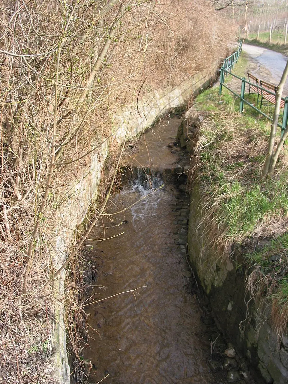
About Schreiberbach
The Schreiberbach, also known locally as the Nußbach, is a small stream in Vienna's 19th district, Döbling. It rises in the Grinzing neighborhood between the Kahlenberg and the Vogelsangberg, where several springs converge in a patch of woodland. In its upper course, the water flows through the Wildgrube in a deeply cut, wooded valley before approaching the Muckental. Here the valley widens and the steep slopes become gentler. The stream follows the Wildgrubgasse through the vineyard-covered Muckental before entering densely built-up areas and passing the Heiligenstädter Friedhof.
The history of the stream is closely tied to the challenges posed by flooding, which particularly threatened the village of Nußdorf. As early as the 19th century, severe floods made roads impassable. To prevent this, the stream was vaulted over and channeled into culverts beginning in the 1880s. Today, the Schreiberbach runs for long stretches in concrete U-shaped channels or underground, regulated by weir walls and reinforced banks. These measures control the speed of the flow and protect the adjacent residential areas.
For visitors, the Schreiberbach offers a near-natural recreational landscape, especially in its upper course. The path along the stream leads through deciduous forests and vineyards that characterize the Vienna Woods region. In the lower stretch, by contrast, urban infrastructure dominates, with reinforced banks and streets. The stream finally empties into a collector sewer that carries the water to the Danube Canal, forming part of Vienna's local drainage system.
At a glance
- Category
- Sight › Historic sites
- Rating
- no reviews yet · write a review
- Address
- —
Vienna, Austria - District
- Döbling
- Phone
- —
- Website
- —
- —
- Coordinates
- 48.25970° N · 16.36610° E
- Data quality
- confidence 0.81
- Identifier
- ID 5e5f18c3-a12…
Location & surroundings
Toggle layersRatings & comments
none yetNear Schreiberbach
closest 5 per category · 2 kmSights
Restaurants
Museums
Hotels
Cocktail bars
None within 2 km.
More:Historic sites in Vienna (518)Sights in Döbling (32)All sights in Vienna (661)
90 places within 2 km loaded.
You need a free account to leave reviews and photos – that keeps comments genuine and lets you edit them later.