Discover Villa de Álvarez: Colima's Neighbor at the Foot of the Volcano
Travel guide · editorialVilla de Álvarez has grown together with Colima into a single city, yet it keeps its own traditions. A trip to Villa de Álvarez leads to a bullring built of wood and palm mats, to archaeological sites, and to views of the Volcán de Fuego.
A Town with a Festival Tradition
The town was formerly called San Francisco de Almoloyan and was renamed in 1860 after Manuel Álvarez, Colima's first governor. For a long time it was an agricultural center, with sugarcane, corn, and cattle ranching. In recent decades it has grown rapidly, new developments such as Residencial Esmeralda and Lo de Villa have sprung up, and today it is home to many families from the greater Colima area. Village-style neighborhoods like Santa Bárbara still recall its rural roots.
Sights in Villa de Álvarez
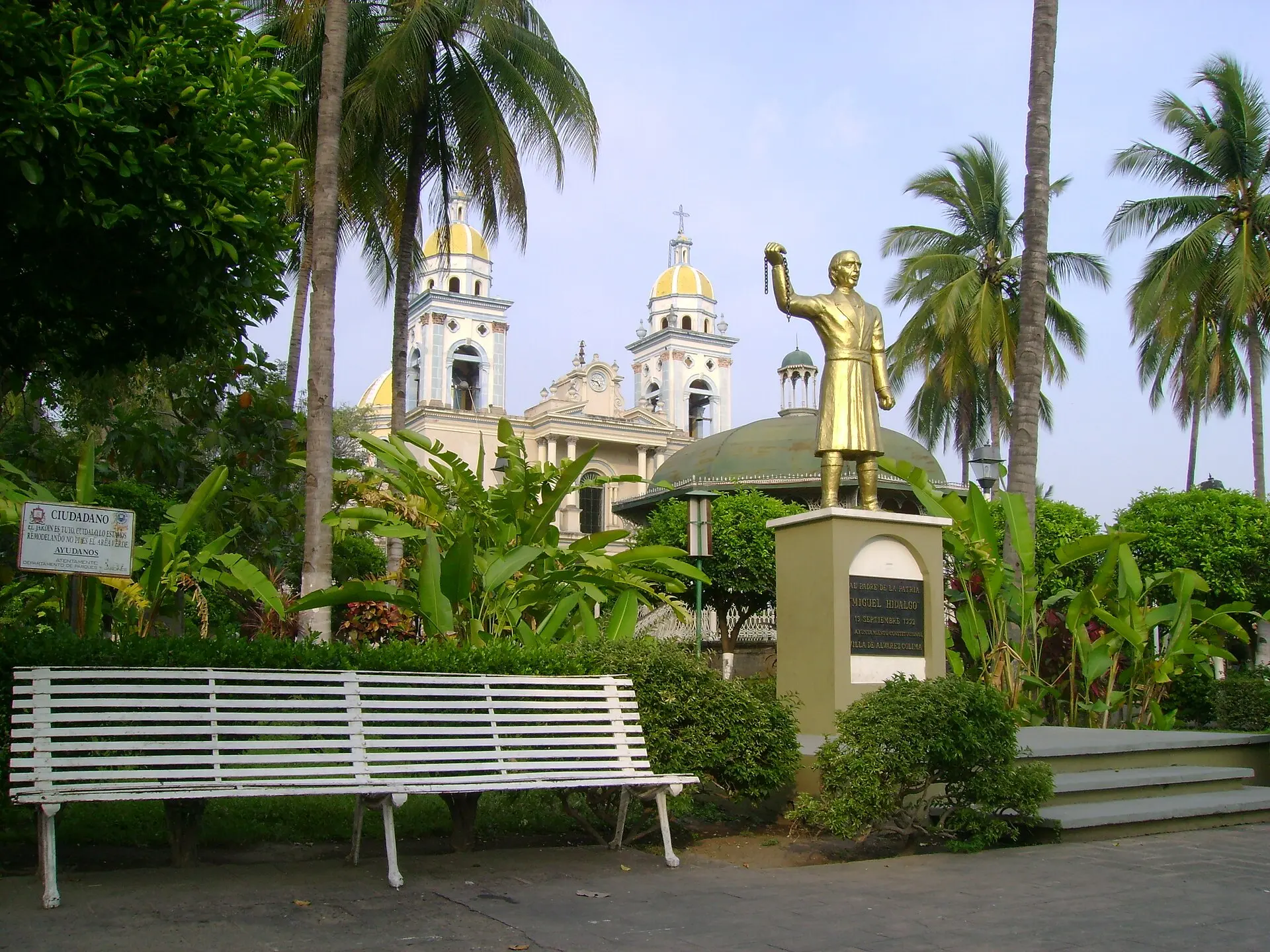
Famous far beyond Colima is La Petatera, a temporary arena that is built each year for the Fiestas Charrotaurinas from wood, rope, and palm mats, without a single nail. The building technique has been passed down for generations and is recognized as cultural heritage of the state. In the center, the Jardín Principal and the Church of San Francisco de Asís invite you to linger. On the edge of town are two archaeological sites: El Chanal, with platforms and a staircase bearing glyphs, and La Campana, one of the region's most important sites, with burial complexes. The area around La Capacha gave its name to one of the earliest ceramic traditions of western Mexico.
Eating in Villa de Álvarez
Villa de Álvarez is the home of sopitos, small fried tortillas topped with ground meat, cabbage, cheese, and a thin tomato sauce. You'll find them at every festival, along with tostadas, pozole seco, and enchiladas. The local drink is tuba, a refreshing coconut palm drink served with peanuts and fruit, as well as tejuino made from fermented corn. In the evening, numerous food stalls open around the Jardín and along the main streets; the restaurants in Villa de Álvarez are mostly inexpensive family-run places.
Excursions to the Volcano and Mountain Villages
Villa de Álvarez lies at the foot of the Volcán de Colima, one of Mexico's most active volcanoes. On clear mornings you can see plumes of smoke above the crater from the edge of town. About 30 minutes to the north is Comala, a village of whitewashed houses and red roofs, known from Juan Rulfo's novel "Pedro Páramo." On the main square, restaurants serve free botanas with your drink, along with sweet bread and ponche. Farther up are the lagoons of La María and Carrizalillo, surrounded by coffee plantations and forests, ideal for walks and birdwatching.
Festivals, Getting There, and Best Time to Visit
The Fiestas Charrotaurinas take place early each year, usually in February, with parades, riders, music, and a fair. Colima's small airport has connections to Mexico City; Manzanillo on the coast, about 90 minutes away, offers more flights. Buses run to Guadalajara, and the Pacific beaches are about an hour away. In recent years Colima has been heavily affected by violent crime; visitors should inform themselves in advance and be careful at night. The best time to visit is from November to April, when it is dry and the volcano often stands out clearly on the horizon.