About Birsigmündung
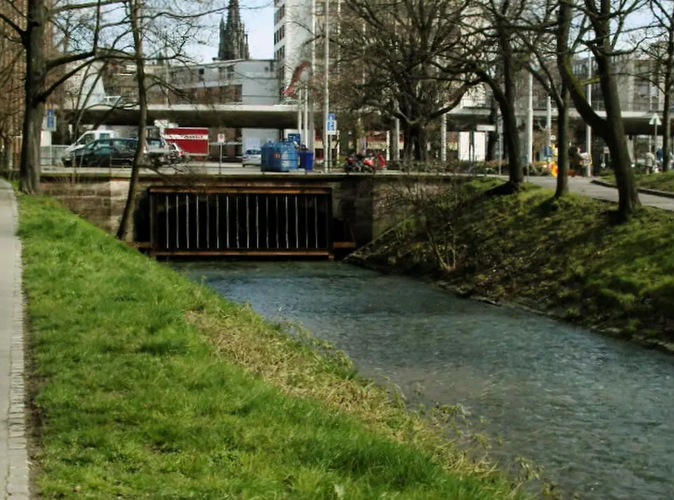
The Birsig estuary in Basel marks the end of a river about twenty kilometers long, which is considered the uppermost left-bank tributary of the Upper Rhine. The Birsig rises in French Alsace and in the Swiss canton of Basel-Landschaft, crossing the national border several times on its way to the city. Its name derives from an original Celtic form and literally means "the fast-flowing one" or "little Birs." The river was first mentioned in writing in the year 1004. While it still flows in the open, albeit straightened, through rural communities such as Oberwil and Binningen, it now runs entirely underground in the area of Basel's city center and Old Town.
You can visit the confluence at the Schifflände, where the Birsig empties into the Rhine at an elevation of 244 meters. At this spot, a pedestrian walkway offers a direct view into the lowest section of the river tunnel that carries the river through the city. Within the city limits, several important bridges cross the Birsig, including the Dorenbach Viaduct, the Birsig Viaduct, and the Heuwaage Viaduct. The latter was originally a railway bridge, before the Alsace line was moved onto a structure of its own. Earlier in its course, the river also passes through the Zoological Garden and the Nachtigallenwäldchen, where the water is fed by an artificially created side channel, the Rümelinbach, which now supplies the ponds and streams in the zoo.
The history of the Birsig is closely tied to the development of the city. In the Middle Ages and the early modern period, the river served as a sewer for the neighboring houses and slaughterhouses, which led to heavy pollution and encouraged the spread of disease. These unsanitary conditions eventually led to the river being channeled underground in the twentieth century. Today, the water quality in the urban area is too poor for swimming, which is why, unlike on the Rhine, there are no developed swimming spots on the Birsig. Only in rural communities such as Leymen, or formerly in Oberwil, did or do small swimming spots used by locals exist.
At a glance
- Category
- Sight › Historic sites
- Rating
- no reviews yet · write a review
- Address
- Drei König-Weglein
4089 Basel, Switzerland - District
- Altstadt Grossbasel
- Phone
- +41616834040
- Website
- —
- —
- Coordinates
- 47.56026° N · 7.58806° E
- Data quality
- confidence 0.80
- Identifier
- ID 7a7f9b8b-5ff…
Location & surroundings
Toggle layersRatings & comments
none yetNear Birsigmündung
closest 5 per category · 2 kmSights
Museums
Hotels
More:Historic sites in Basel (47)All sights in Basel (51)
231 places within 2 km loaded.
You need a free account to leave reviews and photos – that keeps comments genuine and lets you edit them later.