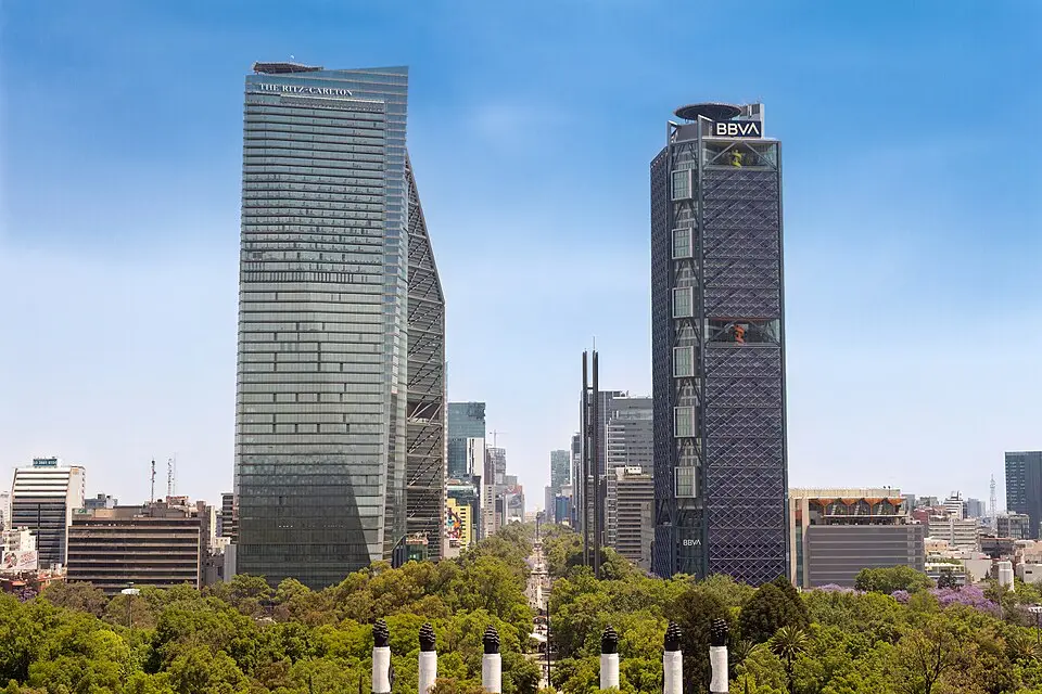
About Reforma Avenue
The Paseo de la Reforma is Mexico City's most important east-west axis, stretching about fifteen kilometers. As the central artery of the metropolis, it largely defines the city's look and links important historic and modern districts. The avenue is roughly sixty meters wide, and its middle section is home to the city's business elite. Here you'll find numerous banks, offices, embassies, and upscale hotels and restaurants. Particularly eye-catching are the modern skyscrapers such as the Torre Mayor, the Torre Reforma, and the Torre BBVA Bancomer, which rank among the tallest buildings in the country. The commercial heart lies between the Avenida Juárez and the entrance to the Bosque de Chapultepec, where you'll also find the Zona Rosa, a district whose streets are named after European cities and which is known for its boutiques and dining.
The history of the avenue goes back to the days of the empire. Emperor Maximilian I had it built to create a direct link between his residence in Chapultepec Castle and his seat of government on the Zócalo. It originally bore the name Calzada del Emperador. After Maximilian was deposed, it was renamed Paseo de los Hombres Ilustres before receiving its present name in honor of the reform laws of President Benito Juárez. The route begins in the northeast at Tlatelolco and passes through a number of important junctions. At the start lies the Plaza de las Tres Culturas, followed by the Glorieta Cuitláhuac, which commemorates the last Aztec ruler, who died of smallpox. Farther southwest is the Plaza Garibaldi, which has developed into the center of mariachi music and has an important metro station.
Another key point is the intersection with the Avenida Hidalgo, where the Baroque church of San Hipólito and the church of San Fernando stand, along with the cemetery where figures such as Benito Juárez are buried. The avenue crosses the Avenida Juárez, which leads to the Zócalo, and the Plaza de la República, at the center of which stands the Monumento a la Revolución. This structure grew out of an unfinished parliament building from the Porfirio Díaz era and today holds the remains of Francisco Madero and Venustiano Carranza. On the traffic circles along this stretch stand monuments to Christopher Columbus and Cuauhtémoc, the last Aztec ruler. The Cuauhtémoc monument was designed by the sculptor Miguel Noreña over a period of nine years and marks the corner with the Avenida de los Insurgentes, the city's great north-south axis.
Probably the avenue's best-known landmark is the Independence Monument, popularly known as El Ángel. It is an obelisk topped by a gilded bronze figure of an angel, reminiscent of Berlin's Victory Column. The monument was dedicated in 1910 to celebrate the centennial of independence and symbolizes victory over Spanish rule. The plaza in front is a popular gathering spot, especially after wins by the Mexican national soccer team. Another striking sculpture is La Diana Cazadora, a bronze figure of the Roman goddess of the hunt, created in 1942. Its history has been marked by controversy: it was initially considered indecent and was reinstalled in its original form only after a renovation ahead of the 1968 Olympic Games.
After a right turn in front of the Bosque de Chapultepec, the avenue runs straight through the park. Here you'll find major cultural institutions such as the Museo de Arte Moderno and the Museo Nacional de Antropología, which displays a comprehensive collection of pre-Hispanic Mexican culture. Nearby are also the Chapultepec Zoo and the Auditorio Nacional. The Torre Mayor, at 225 meters the tallest building in Latin America, stands just before the curve and is engineered to withstand powerful earthquakes. The Paseo de la Reforma thus connects not only the physical parts of the city but also its historical depth with its modern architectural splendor.
At a glance
- Category
- Sight › Historic sites
- Rating
- no reviews yet · write a review
- Address
- —
Mexico City, Mexico - District
- Tabacalera
- Phone
- —
- Website
- —
- —
- Coordinates
- 19.43444° N · -99.15194° E
- Data quality
- confidence 0.76
- Identifier
- ID ad08798c-77e…
Location & surroundings
Toggle layersRatings & comments
none yetNear Reforma Avenue
closest 5 per category · 2 kmSights
Restaurants
Museums
Hotels
More:Historic sites in Mexico City (2,578)Sights in Tabacalera (19)All sights in Mexico City (2,702)
300 places within 2 km loaded.
Don't miss in Mexico City
All sights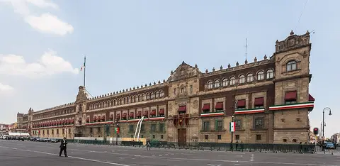 Historic sites01
Palacio Nacional
Avenida Pino Suarez · Mexico City● Website● Phone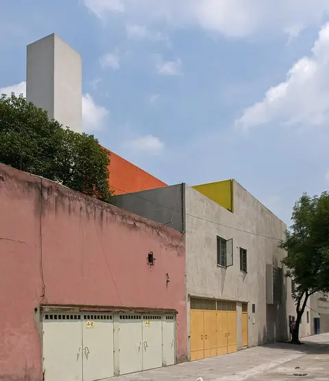 Historic sites02
Casa Estudio Luis Barragán
Gral. Francisco Ramírez 12 · Mexico City● Website● Phone Historic sites03
Av. Paseo de Reforma
Av. P.º de la Reforma 25 · Mexico City○ Website● Phone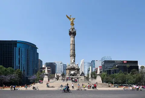 Monuments04
You need a free account to leave reviews and photos – that keeps comments genuine and lets you edit them later.