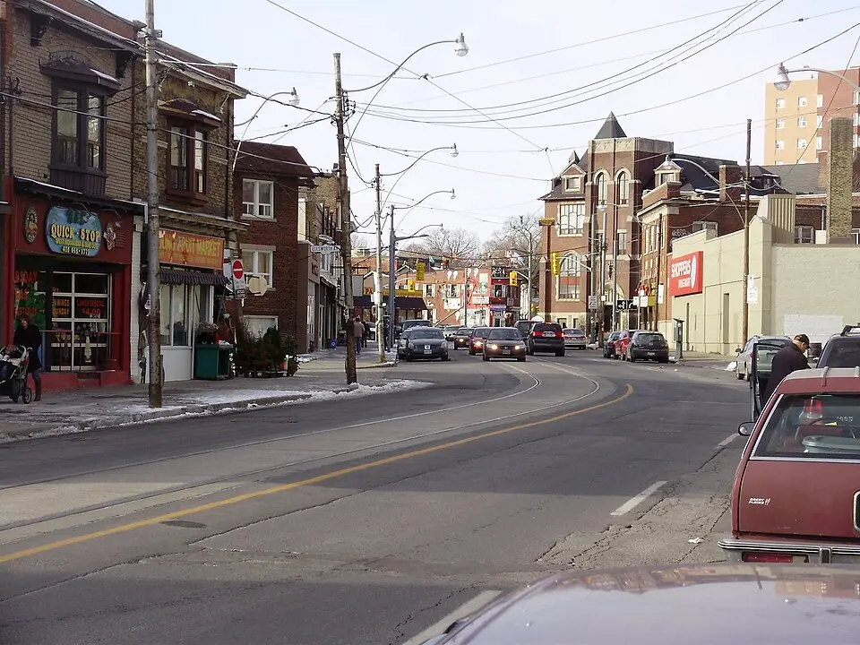
About Vaughan Road
Vaughan Road is a historic street in western Toronto that runs parallel to the buried Castle Frank Brook. Its origins go back to 1850, when it was laid out as an official road, though First Nations peoples had already used it as a path before that. The name comes from the later city of Vaughan, which in turn was named after Benjamin Vaughan, a British commissioner who signed a peace treaty with the United States in 1783. The road runs from Bathurst Street in the south to a dead end at Eglinton Avenue near Fairbank station. Originally, the street continued farther north into what is now Vaughan Township, but over time it was shortened and adjusted, which is still visible in a characteristic curve on Dufferin Street.
For visitors, the street offers a glimpse into the neighborhood's cultural diversity and history. Well-known stops include the independent ice cream shop Dutch Dreams and Albert's Real Jamaican Foods, both of which have been part of local life for decades. Hogtown Mascots, which holds exclusive rights in Canada to make Muppet costumes, is also based here. St. Alphonsus Roman Catholic Church stands out for its architecture and art; it grew out of earlier Presbyterian and United Church congregations. In addition, doors designed by the artist Nikki Abraham and inspired by Piet Mondrian decorate the west side of the street south of St. Clair Avenue. A distinctive feature of the neighborhood is a steel palm tree sculpture at the corner of Oakwood and Vaughan, erected as a tribute to the Caribbean character of the area.
In the 1950s, the street was popular with street racers, since its many curves, which follow the course of the creek, provided ideal conditions. Since 2000, Vaughan Road has been undergoing gentrification, which is especially visible at the corner of Oakwood and Vaughan and in the former City of Toronto. Public transit is served by the 90 Vaughan bus and the 512 St. Clair streetcar. A historic streetcar track that was once part of the Bathurst streetcar loop still serves as an important link for the operation and maintenance of the St. Clair streetcars, even though it is not always explicitly shown as a passenger route on maps.
At a glance
- Category
- Sight › Historic sites
- Rating
- no reviews yet · write a review
- Address
- —
Toronto, Canada - Phone
- +14166563401
- Website
- —
- —
- Coordinates
- 43.68890° N · -79.43250° E
- Data quality
- confidence 0.83
- Identifier
- ID f10661a6-bc1…
Location & surroundings
Toggle layersRatings & comments
none yetNear Vaughan Road
closest 5 per category · 2 kmSights
Restaurants
Museums
Hotels
Cocktail bars
More:Historic sites in Toronto (1,327)All sights in Toronto (1,372)
121 places within 2 km loaded.
You need a free account to leave reviews and photos – that keeps comments genuine and lets you edit them later.