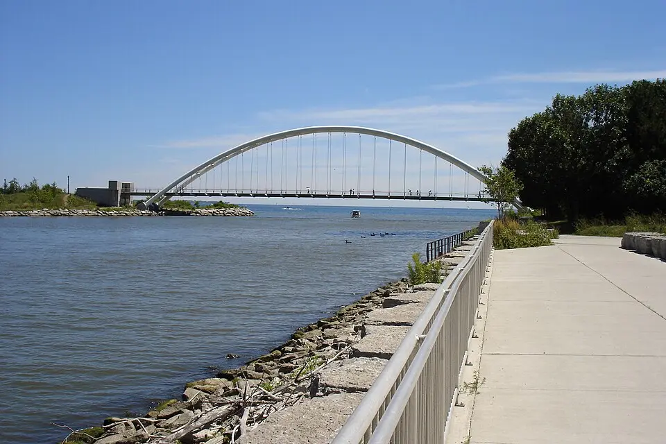
About Martin Goodman Trail
The Martin Goodman Trail is a 56-kilometer multi-use path that runs along Toronto's waterfront on Lake Ontario. It stretches from the Humber Bay Arch Bridge in the west to the Rouge River in the east and is part of the roughly 730-kilometer Waterfront Trail. The path, which opened in 1984, was named after Martin Wise Goodman, then editor-in-chief of the Toronto Star. Since 2005, Waterfront Toronto has been responsible for its maintenance and expansion, including the extension to Tommy Thompson Park and new sections at Ontario Place. In Sunnyside and the Beaches, you can follow the trail alongside the boardwalks and enjoy the connection between city and lake.
At a glance
- Category
- Sight › Historic sites
- Rating
- no reviews yet · write a review
- Address
- —
Toronto, Canada - District
- Fort York-Liberty Village
- Phone
- —
- Website
- en.wikipedia.org
- —
- Coordinates
- 43.63340° N · -79.40440° E
- Data quality
- confidence 0.83
- Identifier
- ID f16fcd4c-9cb…
Location & surroundings
Toggle layersRatings & comments
none yetNear Martin Goodman Trail
closest 5 per category · 2 kmSights
Museums
Hotels
More:Historic sites in Toronto (1,327)All sights in Toronto (1,372)
255 places within 2 km loaded.
You need a free account to leave reviews and photos – that keeps comments genuine and lets you edit them later.