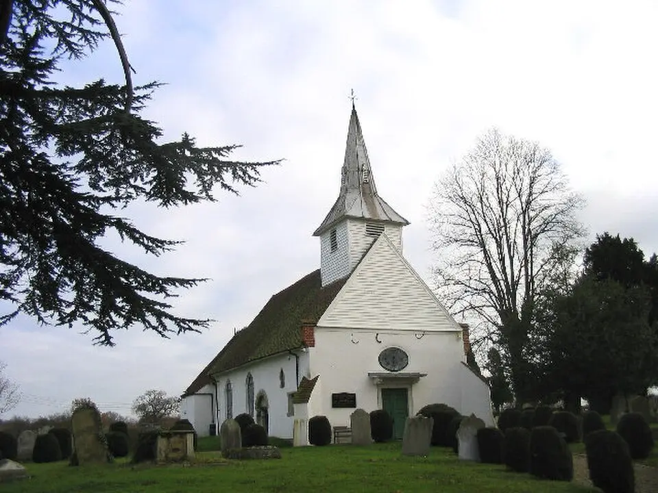
About Lambourne
Lambourne is a rural civil parish in the Epping Forest district of Essex, stretching about 4 miles (7 km) south of Epping. The area lies in the valley of the River Roding, which forms its northern boundary, and is characterized by rolling, agricultural countryside. Historically, the region was heavily wooded in the Middle Ages, and remnants of the ancient Hainault Forest now form part of the adjoining country park. The settlement pattern consists of the village of Abridge in the northwest, the hamlet of Lambourne End in the south, and scattered farms and a few houses. A central landmark is the medieval parish church of St. Mary, which stands in isolation next to the Hall and features an unusual Georgian interior. Lieutenant Colonel Amelius Lockwood, the first Baron Lambourne, is buried in the churchyard. In the east of the parish you will also find Stapleford Aerodrome, which makes the area appealing to aviation enthusiasts as well.
At a glance
- Category
- Sight › Historic sites
- Rating
- no reviews yet · write a review
- Address
- —
London, United Kingdom - District
- Epping Forest
- Phone
- —
- Website
- —
- —
- Coordinates
- 51.63800° N · 0.13000° E
- Data quality
- confidence 0.81
- Identifier
- ID 8b7f9a65-9df…
Location & surroundings
Toggle layersRatings & comments
none yetNear Lambourne
closest 5 per category · 2 kmRestaurants
Museums
None within 2 km.
Cocktail bars
None within 2 km.
More:Historic sites in London (3,142)Sights in Epping Forest (26)All sights in London (3,487)
9 places within 2 km loaded.

You need a free account to leave reviews and photos – that keeps comments genuine and lets you edit them later.