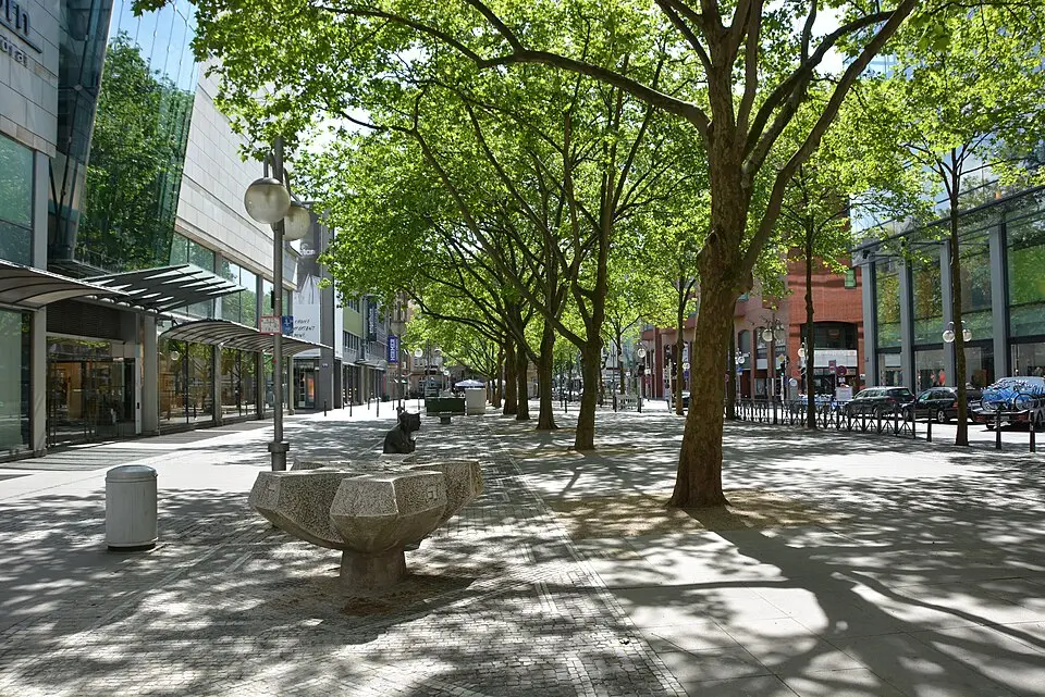
About Kapuzinerplatz
Kapuzinerplatz, officially called Kapuzinerplanken, is a green public square in downtown Mannheim that stretches across the grid blocks O 5 and O 6. Named after the Capuchin monastery that stood here from 1701 to 1839, it forms the northern remnant of the former monastery grounds, which were split apart when today's Kunststraße was built. A pedestrian zone about 145 meters (roughly 475 feet) long, the square invites you to linger and is home to the Blumepeter monument, among other sights. Here you can experience a lively market scene, ranging from an organic farmers' market on Fridays to seasonal events such as the White Christmas Market and regular inline skating runs in summer.
At a glance
- Category
- Sight › Historic sites
- Rating
- no reviews yet · write a review
- Address
68161 Mannheim, Germany- District
- Innenstadt
- Phone
- —
- Website
- —
- —
- Coordinates
- 49.48538° N · 8.46835° E
- Data quality
- confidence 0.90
- Identifier
- ID f243b453-f8e…
Location & surroundings
Toggle layersRatings & comments
none yetNear Kapuzinerplatz
closest 5 per category · 2 kmSights
Restaurants
Museums
Hotels
More:Historic sites in Mannheim (22)All sights in Mannheim (25)
186 places within 2 km loaded.
You need a free account to leave reviews and photos – that keeps comments genuine and lets you edit them later.