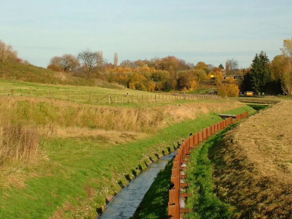
About Rüpingsbach
The Rüpingsbach is an eight-kilometer-long (5-mile) stream in southern Dortmund, formed where the Grotenbach and the Kirchhörder Bach meet. Originally, the stream was part of the Emscher system's wastewater network and flowed through a concrete channel. As part of the Emschergenossenschaft's reconstruction project, it was restored to a natural state and now carries clean water again. You can explore the stream along a newly built riverside path in the An der Panne nature reserve. The path passes historic reminders of the industrial era, such as the former Rüpingsmühle mill and the railway embankment of the Henriette colliery, all explained by informative signs. Another highlight is a participatory vineyard where Cabaret Noir grapes are grown. While the Rüpingsbach has already been restored, work on the Grotenbach and the Kirchhörder Bach is still underway, with completion planned for 2028.
At a glance
- Category
- Sight › Historic sites
- Rating
- no reviews yet · write a review
- Address
- —
Dortmund, Germany - District
- Hombruch
- Phone
- —
- Website
- —
- —
- Coordinates
- 51.49330° N · 7.43845° E
- Data quality
- confidence 0.81
- Identifier
- ID 913744bf-238…
Location & surroundings
Toggle layersRatings & comments
none yetNear Rüpingsbach
closest 5 per category · 2 kmRestaurants
Museums
Hotels
Cocktail bars
None within 2 km.
More:Historic sites in Dortmund (64)All sights in Dortmund (72)
84 places within 2 km loaded.
You need a free account to leave reviews and photos – that keeps comments genuine and lets you edit them later.