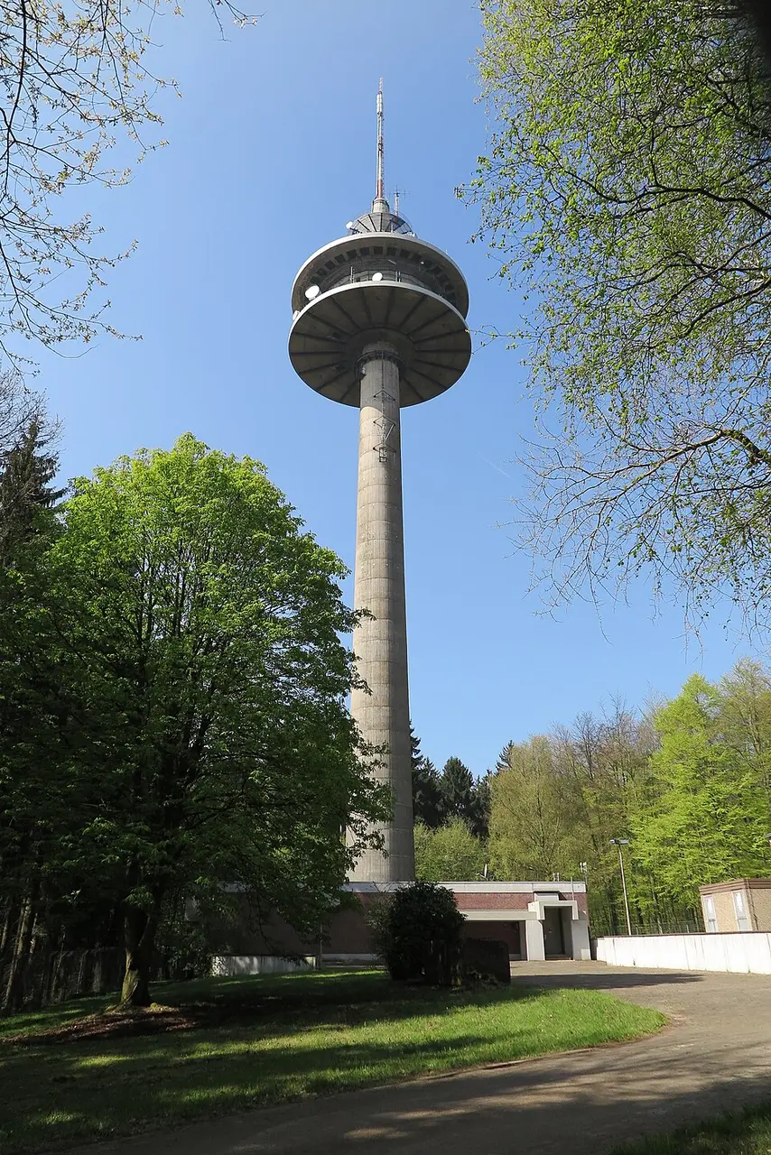
About Mulleklenkes
The Mulleklenkes is a 133-meter-tall (436-foot) broadcasting tower on the Karlshöhe in Aachen's city forest. Located about seven kilometers (4.3 miles) southwest of the city center, it stands right next to the Belgian border and the Three Countries Corner. This position makes it the westernmost transmitter in Germany. The tower, an FMT 12 type, was completed in 1984 and is operated by Deutsche Funkturm. The name is not a nickname but the official designation, which combines the Rhenish words for chatting with Aachen's well-known gesture of the outstretched little finger.
For visitors and locals alike, the site is known mainly as technical infrastructure that supplies the region's broadcast programming. Local FM radio has been transmitted from here since the 1990s, and today it includes the Antenne AC program for the Aachen region. The tower also serves as an important hub for digital radio reception in the DAB+ standard and for the distribution of digital television using the DVB-T2 HD system. The facility operates in single-frequency mode with other transmitter sites, and because of frequency allocations near the border, the signal toward the west is directional.
At a glance
- Category
- Sight › Historic sites
- Rating
- no reviews yet · write a review
- Address
- Unterer Backertsweg
52074 Aachen, Germany - Phone
- —
- Website
- —
- —
- Coordinates
- 50.74567° N · 6.04340° E
- Data quality
- confidence 0.85
- Identifier
- ID 1072e5c6-b53…
Location & surroundings
Toggle layersRatings & comments
none yetNear Mulleklenkes
closest 5 per category · 2 kmSights
Restaurants
Museums
None within 2 km.
Hotels
None within 2 km.
Cocktail bars
None within 2 km.
More:Historic sites in Aachen (77)All sights in Aachen (91)
16 places within 2 km loaded.
You need a free account to leave reviews and photos – that keeps comments genuine and lets you edit them later.