About Marienturm
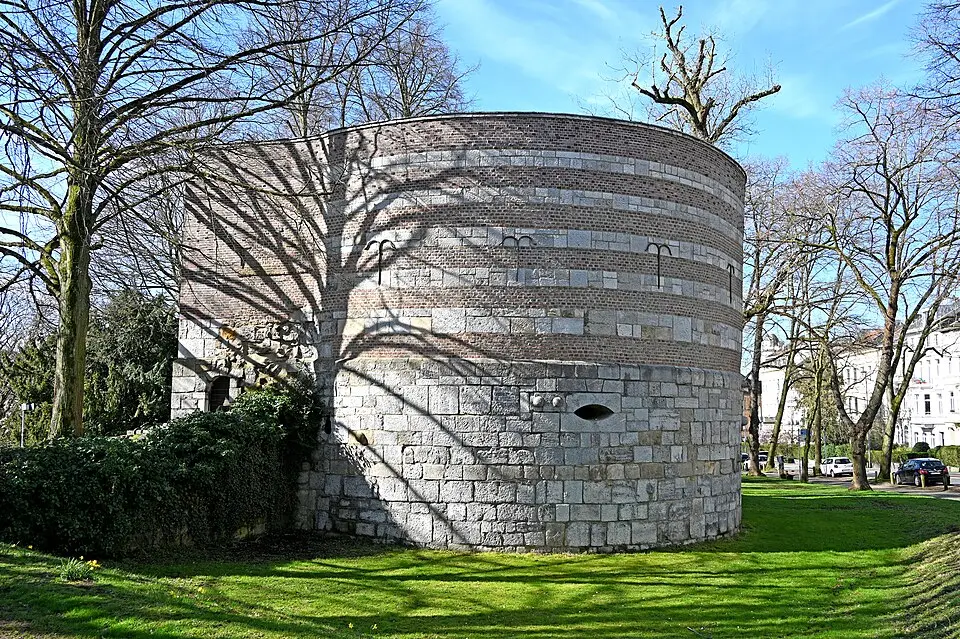
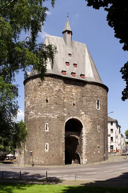
The Marienturm (Mary's Tower), also known as the Marienburg, is a historic defensive tower in the north of Aachen and one of the few surviving remnants of the city's outer fortifications. Its name goes back to the laying of the foundation stone on August 14, 1512, the day before the Feast of the Assumption of Mary. It was built to replace the older, taller Breuerturm, since the cannon technology emerging at the time called for a lower, sturdier design. Its walls, four meters thick, offered better protection than the thin-walled earlier structures. Today the tower is a popular destination for outings and part of the city's protected architectural heritage.
Architecturally, the structure stands out for its massive rounded form, 14.70 meters in diameter, and a square projecting section facing the city. Originally it served defensive purposes with embrasures, some of which were designed for cannons. Since 1933, the ground floor has housed a memorial to the victims of the world wars, which includes a stone sarcophagus. The exterior walls still bear witness to the fighting of the Thirty Years' War, with visible bullet and shell impact holes.
The tower is surrounded by an idyllic garden with a pond, created as part of the transformation of the moat ring into a continuous green belt. Trees such as an old horse chestnut and a hornbeam shape the look of this tranquil oasis. After suffering heavy damage in World War II, the building was restored between 1950 and 1955 and now stands as a quiet testament to Aachen's military and cultural history.
At a glance
- Category
- Sight › Historic sites
- Rating
- no reviews yet · write a review
- Address
- Ludwigsallee 51
52062 Aachen, Germany - Phone
- +492414320
- Website
- —
- —
- Coordinates
- 50.78241° N · 6.08213° E
- Data quality
- confidence 0.55
- Identifier
- ID 7b672c6d-a2d…
Location & surroundings
Toggle layersRatings & comments
none yetNear Marienturm
closest 5 per category · 2 kmRestaurants
Museums
Hotels
More:Historic sites in Aachen (77)All sights in Aachen (91)
207 places within 2 km loaded.
You need a free account to leave reviews and photos – that keeps comments genuine and lets you edit them later.