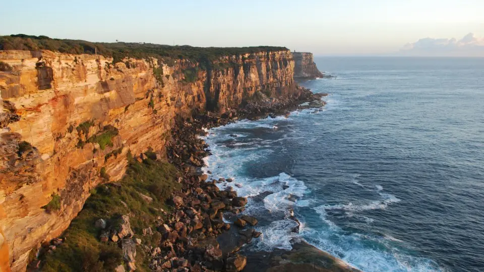
About Sydney Basin
The Sydney Basin is one of the most densely populated regions in Australia, home to around four million people. Geologically, it is a sedimentary basin on the east coast of New South Wales, made up of deposits from the Permian and Triassic periods. It stretches from Newcastle in the north to Batemans Bay in the south and extends west to the Blue Mountains. For a long time, this mountain range formed a natural barrier that European settlers did not cross until 1813, opening the way for settlement of the Australian interior. The basin is part of the larger Sydney-Gunnedah-Bowen system and holds significant coal mines as well as natural gas fields.
The region's history reaches back thousands of years before the arrival of Europeans, when Aboriginal people lived here as hunters and gatherers. They left behind numerous cultural traces, including about 1,500 rock engravings in the north and on the Woronora Plateau. With the arrival of the First Fleet in 1788, settlement by convicts began, first at Port Jackson, today's Sydney. The early settlers relied on exports of wool, timber, and seal products, while farming spread along the Parramatta and Hawkesbury rivers. In the 19th century, the city grew rapidly with the construction of railways and tramways, and suburbs sprang up to house the growing population.
Today the Sydney Basin is Australia's most important economic hub, with numerous banks and corporate headquarters. Alongside Sydney, Newcastle and Wollongong have developed into major industrial centers shaped by coal, steel, and port logistics. The landscape is varied, taking in the rolling Cumberland Plain, the Blue Mountains plateau with its deep gorges, and the Hornsby and Woronora plateaus. The latter is especially important, as most of Sydney's drinking water is sourced here. The climate is warm, with mild winters in the mountains and summer-like temperatures on the coast. Visitors can explore geological formations such as Hawkesbury Sandstone, which was historically used in building the city, as well as the region's natural parks and coastlines.
At a glance
- Category
- Sight › Historic sites
- Rating
- no reviews yet · write a review
- Address
- —
Sydney, Australia - Phone
- —
- Website
- —
- —
- Coordinates
- -33.94810° N · 150.76000° E
- Data quality
- confidence 0.74
- Identifier
- ID b020a1ce-257…
Location & surroundings
Toggle layersFAQ about Sydney Basin
quick answersWhat is the Sydney Basin?
The Sydney Basin is a geological sedimentary basin on the east coast of New South Wales, Australia, made up of Permian and Triassic deposits. It stretches from Newcastle in the north to Batemans Bay in the south and reaches west as far as the Blue Mountains. With around four million residents, the Sydney Basin is one of the most densely populated regions in Australia. It is part of the larger Sydney-Gunnedah-Bowen system and is home to significant coal mines as well as natural gas fields.
What traces of Aboriginal culture can you find in the Sydney Basin?
In the Sydney Basin around Sydney, there are about 1,500 Aboriginal rock engravings, mainly in the north and on the Woronora Plateau. Aboriginal people lived here as hunter-gatherers for thousands of years before Europeans arrived. These rock engravings are among the many cultural traces they left behind in the region.
How did European settlement of the Sydney Basin unfold?
European settlement of the Sydney Basin began in 1788 with the arrival of the First Fleet, whose convicts first settled at Port Jackson, present-day Sydney. The early settlers made their living from exporting wool, timber, and seal products, while farming spread along the Parramatta and Hawkesbury Rivers. It wasn't until 1813 that European settlers crossed the Blue Mountains, which had long formed a natural barrier, opening up the hinterland for settlement. In the 19th century, Sydney grew rapidly with the construction of railways and tramways, and new suburbs emerged.
What can you explore in the Sydney Basin?
In the Sydney Basin near Sydney, you can explore geological formations such as Hawkesbury Sandstone, natural parks, and coastlines. Hawkesbury Sandstone was historically used in building the city. The landscape includes the rolling Cumberland Plain, the Blue Mountains plateau with its deep gorges, and the Hornsby and Woronora plateaus. Most of Sydney's drinking water is collected on the Woronora Plateau.
What economic role does the Sydney Basin play today?
Today the Sydney Basin is Australia's most important economic hub, with numerous banks and corporate headquarters in Sydney. Besides Sydney, Newcastle and Wollongong have developed into significant industrial centers shaped by coal, steel, and port logistics. The region's climate is warm, with mild winters in the mountains and summer temperatures along the coast.
Ratings & comments
none yetNear Sydney Basin
closest 5 per category · 2 kmSights
Restaurants
Museums
None within 2 km.
Hotels
None within 2 km.
Cocktail bars
None within 2 km.
More:Historic sites in Sydney (1,315)All sights in Sydney (1,401)
3 places within 2 km loaded.
Don't miss in Sydney
All sights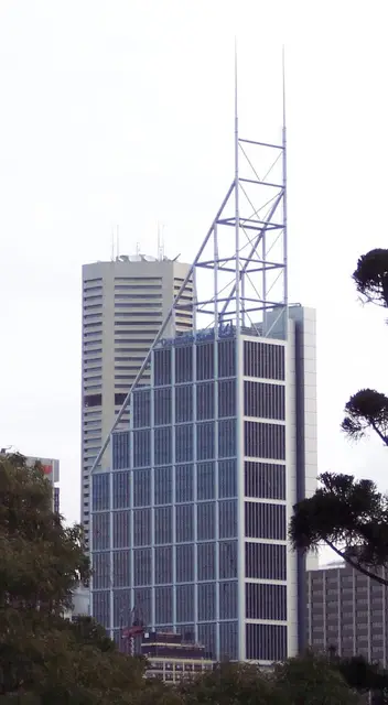 Historic sites01
Deutsche Bank Place
Level 16 Corner of Hunter and, Phillip St · Sydney● Website● Phone Monuments02
Archibald Fountain
Prince Albert Rd · Sydney● Website● Phone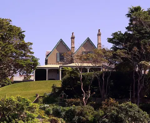 Historic sites03
Kirribilli House
109 Kirribilli Ave · Sydney● Website● Phone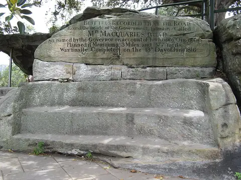 Historic sites04
You need a free account to leave reviews and photos – that keeps comments genuine and lets you edit them later.