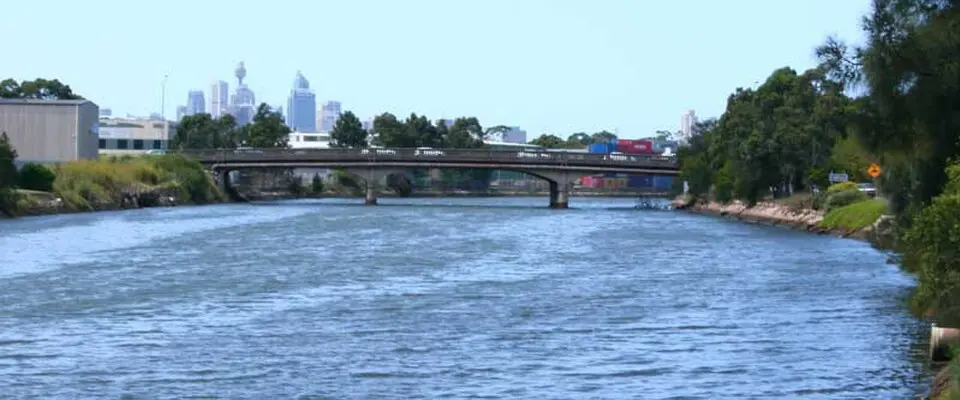
About Alexandra Canal
Alexandra Canal is a man-made waterway in the south of Sydney and one of the few navigable canals in New South Wales. Named after Princess Alexandra, who married the future King Edward VII in 1863, the canal stretches for four kilometers. It flows from the inner-city suburb of Alexandria through St Peters and Mascot, past Sydney Airport, and empties into the Cooks River at Tempe, which in turn drains into Botany Bay. This area was originally known as Shea's Creek, a saltmarsh waterway that was heavily polluted by industry. To solve the sewage problems and at the same time create new industrial opportunities, work began in 1887 to convert the creek into a canal. During the economic depression of the 1890s, the project also served as a job-creation scheme for the unemployed. The banks were reinforced with dry-laid sandstone, a method of construction that survives in parts to this day and gives the canal its distinctive, textured look.
Although the canal was largely completed by 1900 to serve as a transport route for goods and to turn the area into an industrial hub, it remained an economic failure. Factors such as shallow water, constant sediment buildup, tides, and the rise of road transport in the 1930s meant that its use as a waterway gradually ceased. The landing stages were eventually demolished. During World War II, the eastern banks were used to store wool in makeshift sheds, some of which still stand today as heritage-listed buildings. Later airport expansions between 1947 and 1970 also altered the canal's course near the Cooks River.
Today, Alexandra Canal is above all a historic and scenic landmark. It is listed on the New South Wales State Heritage Register as a rare example of late 19th-century coastal engineering. Excavations in 1896 also uncovered the bones of a dugong as well as stone axes, which yielded important insights into early settlement by Indigenous Australians and historic changes in sea level. Despite various plans, discussed in the early 2000s, to convert it into a recreation area with cycle paths and dining, large-scale redevelopment was put on hold over safety concerns about the contaminated sediments. Today you can experience the canal as part of the region's industrial backdrop, especially from the vantage point of the surrounding bridges.
At a glance
- Category
- Sight › Historic sites
- Rating
- no reviews yet · write a review
- Address
- —
Sydney, Australia - District
- Mascot
- Phone
- —
- Website
- —
- —
- Coordinates
- -33.93310° N · 151.16200° E
- Data quality
- confidence 0.80
- Identifier
- ID 763dc6d2-de4…
Location & surroundings
Toggle layersFAQ about Alexandra Canal
quick answersWhat is the Alexandra Canal in Sydney?
The Alexandra Canal is a man-made waterway about 4 kilometers (2.5 miles) long in the south of Sydney and is considered one of the few navigable canals in New South Wales. It flows from Alexandria through St Peters and Mascot, past Sydney Airport, and empties into the Cooks River at Tempe, which drains into Botany Bay. It is named after Princess Alexandra, who married the future King Edward VII in 1863.
How did the Alexandra Canal in Sydney come about?
The Alexandra Canal was created starting in 1887 by converting Shea’s Creek, a saltmarsh waterway heavily polluted by industry. The goal was to solve sewage problems and create a transport route for goods; during the economic depression of the 1890s, the project also served as a job-creation measure. Although the canal was largely finished by around 1900, it remained an economic failure due to shallow water, sediment, tides, and the rise of road transport in the 1930s.
Why is the Alexandra Canal heritage-listed?
The Alexandra Canal is on the New South Wales State Heritage Register because it is regarded as a rare example of late 19th-century coastal engineering. Typical features include the banks reinforced with dry-laid sandstone, some of which survive to this day. Excavations in 1896 also uncovered dugong bones and stone axes, which provided insights into early Indigenous settlement and earlier sea levels.
How can you experience the Alexandra Canal in Sydney today?
Today you experience the Alexandra Canal in Sydney mainly as part of the industrial backdrop of the Mascot neighborhood, especially from the surrounding bridges. On the east bank, a few heritage-listed halls still stand that were used to store wool during World War II. Plans from the early 2000s for a recreation area with bike paths and dining were put on hold because of contaminated sediment.
What can you see around the Alexandra Canal?
Several historic sites lie near the Alexandra Canal in Sydney. travelguide195 lists the Cooks River Dam about 264 meters (870 feet) away and the Tempe Historic House museum about 807 meters (0.5 miles) away. For a break, travelguide195 also lists around 11 restaurants within 500 meters (0.3 miles).
Ratings & comments
none yetNear Alexandra Canal
closest 5 per category · 2 kmSights
Restaurants
Hotels
Cocktail bars
More:Historic sites in Sydney (1,315)All sights in Sydney (1,401)
95 places within 2 km loaded.
Don't miss in Sydney
All sights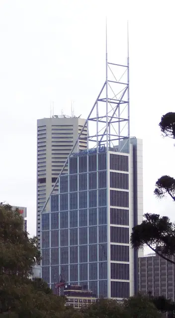 Historic sites01
Deutsche Bank Place
Level 16 Corner of Hunter and, Phillip St · Sydney● Website● Phone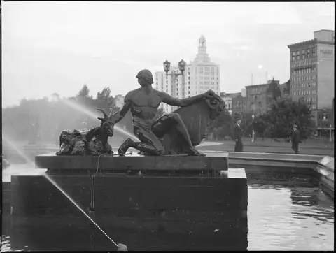 Monuments02
Archibald Fountain
Prince Albert Rd · Sydney● Website● Phone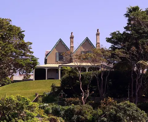 Historic sites03
Kirribilli House
109 Kirribilli Ave · Sydney● Website● Phone Historic sites04
You need a free account to leave reviews and photos – that keeps comments genuine and lets you edit them later.