About Old Hay Brook
The Old Hay Brook is a small river in the south of Sheffield, formed by several headwater streams on the moors southwest of the city center. The streams, including the Redcar Brook and the Blacka Dike, join to form the brook, which later merges with the Totley Brook at Totley Rise to create the River Sheaf. Historically, the water of this river was of great economic importance, as it powered the waterwheels of mills from the late 16th century onward. These facilities were originally used for papermaking, lead processing, and grain milling. With the rise of Sheffield's metal industry, the mills increasingly turned into grinding workshops for sickles and saws in the 19th century. By 1900, all of the mills had been shut down, but some technical remnants such as weirs and dams can still be seen along the river today.
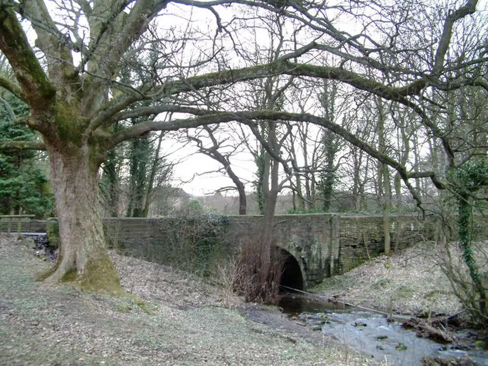
Along the brook, you can visit a number of historic structures that bear witness to the area's industrial past. One particular highlight is a small footbridge from the late 18th century, built of dressed stone and ashlar. It has a single arch and was restored in the 20th century. A large, U-shaped brick aqueduct also shapes the landscape, carrying the brook across the cutting of the Totley Tunnel. Near the railway line, you will find more stepped brick weirs that were once part of the old water-power system.
The history of the individual mill sites is closely tied to the development of local industry. The former Totley Forge, for example, operated as a paper mill in the 17th century before being converted into a sickle forge; its buildings were later turned into barns and are now used as stables. Other sites, such as the Old Hay Wheel, were first used for lead smelting before also serving metalworking until the buildings were demolished. The Upper Mill and the Nether Mill likewise went through similar transformations, from grain or lead processing to the production of agricultural tools. While most of the buildings have disappeared, the surviving water-management structures and converted buildings are a reminder of how intensively water power was used in this region.
At a glance
- Category
- Sight › Historic sites
- Rating
- no reviews yet · write a review
- Address
- —
Sheffield, United Kingdom - Phone
- —
- Website
- —
- —
- Coordinates
- 53.31800° N · -1.53300° E
- Data quality
- confidence 0.83
- Identifier
- ID 4d44fb06-722…
Location & surroundings
Toggle layersRatings & comments
none yetNear Old Hay Brook
closest 5 per category · 2 kmSights
None within 2 km.
Restaurants
Museums
None within 2 km.
Cocktail bars
None within 2 km.
More:Historic sites in Sheffield (133)All sights in Sheffield (148)
15 places within 2 km loaded.
You need a free account to leave reviews and photos – that keeps comments genuine and lets you edit them later.