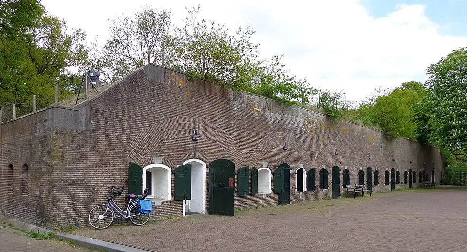
About Fort Blauwkapel
Fort Blauwkapel is a historic fortress near Utrecht that was built as part of the New Dutch Waterline. The site's strategic importance goes back to 1787, when a fortification was first built there. After it fell into disrepair, a new earthwork was constructed between 1818 and 1821, enclosing what was then the village of Blauwkapel within its ramparts. The complex was protected by a moat, which also crossed the road to Hilversum. Over the course of the 19th century, the fort was expanded with stone buildings, including a guardhouse that was built between 1849 and 1852 and later covered with a protective layer of earth. Other structures, such as a bombproof barracks and a large wooden chalet-style barracks, completed the military complex. During World War I, the fort served as an infantry stronghold with trenches and observation posts.
The fort played a special role from 1945 to 1947, when it was used after World War II as an interrogation center and detention facility for political offenders. High-ranking members of the SS and SD, as well as collaborators, were held here and questioned by a mixed team of Canadian, British, and Dutch investigators. Conditions of confinement at the time were basic and often harsh, which led to various abuses and a notorious escape. After the camp was dissolved in the late 1940s, the fort lost its military function and was used at times for cultural events.
Today, Fort Blauwkapel is a protected townscape and is recognized as a national monument. After the City of Utrecht acquired it in the 1990s, the complex underwent extensive restoration. The fort's moats were restored, and historic buildings such as the guardhouse and the barracks were renovated. The grounds now include residential housing, a public recreation area, and a scouting group. You can explore the historic structures and visit the fort along the Waterline Trail, which traces the historic line of defense.
At a glance
- Category
- Sight › Historic sites
- Rating
- no reviews yet · write a review
- Address
- Kapelweg 1
3566 MK Utrecht, Netherlands - Phone
- +31620715932
- Website
- www.fortblauwkapelvergaderen.nl
- —
- Coordinates
- 52.11463° N · 5.13894° E
- Data quality
- confidence 0.98
- Identifier
- ID a6b51c58-285…
Location & surroundings
Toggle layersRatings & comments
none yetNear Fort Blauwkapel
closest 5 per category · 2 kmSights
Restaurants
Museums
None within 2 km.
Hotels
Cocktail bars
More:Historic sites in Utrecht (118)All sights in Utrecht (138)
93 places within 2 km loaded.
You need a free account to leave reviews and photos – that keeps comments genuine and lets you edit them later.